Genesis 19:23: A journey with a time on it, and two answers to how far it was
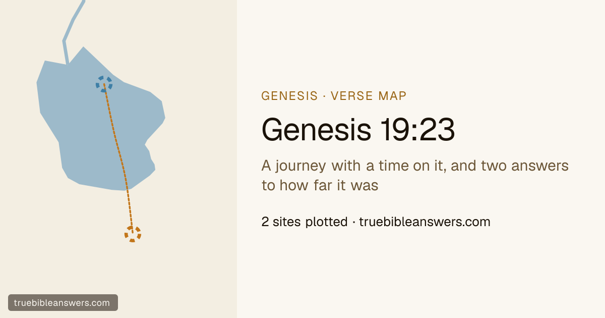
Read it →"The sun had risen on the earth when Lot came to Zoar." One of the shortest sentences in the chapter and the only one that times anything. The angels had taken him by the hand at first light and put him outside the city; he had been told to run for the hills and had begged to be allowed a town instead — "this city is near enough to flee to, and it is a little one" — and the little one was granted and given the name Zoar, which means exactly that. The sun coming up is the clock striking: nothing can happen to the plain until he is inside. How far he ran is the one thing the sources cannot agree on, and the disagreement matters more here than anywhere else in the story, so the map draws both answers instead of choosing. On the majority reading, Zoar stood on the same drowned plain south of the Lisan as Sodom itself, and the two points the atlases give are the same point — which would make the flight a matter of a few hundred yards and the whole argument about being near enough rather beside the point. On the other, Zoar is Ghor es-Safi at the south-east corner of the sea, where the Wadi Hasa comes down off the Moabite plateau: twelve miles, which is a hard hour and a half at a run and is genuinely near enough when the alternative is the hills. Ghor es-Safi has the tradition. Byzantine pilgrims went there under the name Zoar, a monastery and a church were built on it, and the Madaba mosaic map labels the spot. It also has the only ground on the frame that Genesis 19:30 can happen on: Lot goes up out of Zoar afterwards and lives in a cave in the hills, and the escarpment behind Ghor es-Safi is right there. The blue ring and the orange one are the two readings. Only one of them leaves a line to draw.
Regions on this map
Out of the city at first light, with the sun up by the time he was inside the little one. The distance depends entirely on which of the two Zoars you take, and the map draws both.
The little city, and the name is the argument: Lot asks for it because it is near enough to reach and small enough not to matter, and the angel grants it and calls it Little. It is the only one of the five cities of the plain to survive the chapter, and Lot is afraid of it inside a week and leaves. Where it stood is the one identification in this story worth arguing about, because the two candidates are twelve miles and a whole reading of the sentence apart.
Not pinned: 466 of its votes put it on the plain south of the Lisan — Sodom's own point, now under the water — and 305 put it at Ghor es-Safi twelve miles further south, and the difference between them is the difference between a flight of no distance and a flight of twelve miles.
Genesis 19:23 in full
- Genesis 19:23The sun had risen on the earth when Lot came to .
Where the sources put the contested places
One name on this map carries no pin, because the sources have not settled where it is. Every site proposed is drawn instead, in the colour of the reconstruction it belongs to.
- Under the southern basin
- The majority reading, and the one the whole cluster of the cities of the plain rests on: Sodom, Gomorrah, Admah, Zeboiim and Zoar all stood on the flat ground south of the Lisan, which the Dead Sea has since risen over. It explains why no tell has ever been found for any of them, and it is why Zoar's leading point and Sodom's are the same dot.
- Ghor es-Safi
- The one rival with ground you can stand on: the oasis at the sea's south-east corner, where the Wadi Hasa comes down off the Moabite plateau. Byzantine pilgrims went there as Zoar, a church was built over the site, and the Madaba mosaic map labels it. It is the only candidate that leaves Lot a run to make and hills to go up into afterwards.
Zoar
The little city, and the name is the argument: Lot asks for it because it is near enough to reach and small enough not to matter, and the angel grants it and calls it Little. It is the only one of the five cities of the plain to survive the chapter, and Lot is afraid of it inside a week and leaves. Where it stood is the one identification in this story worth arguing about, because the two candidates are twelve miles and a whole reading of the sentence apart.
Not pinned: 466 of its votes put it on the plain south of the Lisan — Sodom's own point, now under the water — and 305 put it at Ghor es-Safi twelve miles further south, and the difference between them is the difference between a flight of no distance and a flight of twelve miles.
Under the southern basin466 of 771 votes
- the plain south of the Lisan · 466 votes — The largest block of votes, and the same point the sources give Sodom, Gomorrah, Admah and Zeboiim. It puts the little city among the four it was spared beside, on ground the sea has since covered.
Ghor es-Safi305 of 771 votes
- Ghor es-Safi · 305 votes — Byzantine tradition is unanimous about it: a church, a monastery and a place on the Madaba map, all under the name Zoar. It sits where the Wadi Hasa opens onto the plain, with the Moabite escarpment directly behind it.