Genesis 14:5: Three peoples beaten in one sentence, on a road running south
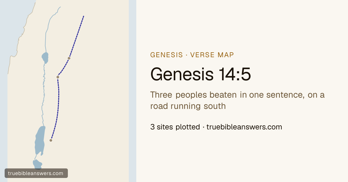
Read it →"In the fourteenth year Chedorlaomer and the kings who were with him came and defeated the Rephaim in Ashteroth-karnaim, the Zuzim in Ham, and the Emim in Shaveh-kiriathaim." This is where Genesis 14 turns from a list of names into a campaign, and the map is the argument for taking it seriously. The three places are not scattered. They lie on one line, running roughly a hundred and forty miles north to south down the high tableland east of the Jordan — the road later called the King's Highway, the only through route on that side of the rift, and the one every army coming down out of Syria has used. Ashteroth-karnaim is in Bashan, north of the Yarmuk; Ham is in Gilead; Shaveh-kiriathaim is on the Moabite plateau above the Dead Sea. The kings are not raiding. They are clearing a corridor, in order, from the top. The three peoples are the ones Israelite memory filed as giants. Rephaim, Zuzim and Emim are all names Deuteronomy will use for the tall aboriginal population east of the Jordan whom the Ammonites and Moabites displaced — "a people great and many, and tall as the Anakim." Genesis 14 is the only place they are met as going concerns rather than as a memory, and they lose. The fourteenth year matters because the verse before it has set the clock: twelve years the five cities served Chedorlaomer, in the thirteenth they rebelled, and in the fourteenth the army came. This is a punitive expedition on a schedule, and it does not go straight at the rebels. It comes the long way, down the eastern road, taking out everything that might come in behind it, and only then swings west and south around the bottom of the Dead Sea. Lot has been living in Sodom for one chapter.
Regions on this map
Down the eastern tableland in order, north to south: Bashan, then Gilead, then the Moabite plateau. It is the road later called the King's Highway, and it is the only through route east of the rift.
Three towns and three peoples, each beaten in half a clause. Abraham never goes to any of them; they are on his map because the army that takes them is fourteen days from taking his nephew.
The northernmost of the three and the first to fall: a town in Bashan, the high basalt country north of the Yarmuk, named for the goddess Astarte and for a pair of horns. Deuteronomy remembers it as the seat of Og, the last of the Rephaim, whose iron bedstead was still being measured in Rabbah.
Today: Tell Ashtarah, Daraa, Syria
The middle town, in Gilead, and the least known of the three — it appears in the Bible only here. The Egyptian execration texts of the nineteenth century BC name a town that may be the same one, which is one of the reasons this chapter's geography is taken as old.
Today: Tell Ham, Irbid, Jordan
The plain of Kiriathaim, on the Moabite plateau east of the Dead Sea and the last stop before the road turns south into Edom. The Emim who lose it here are the people Deuteronomy says the Moabites called giants: "a people great and many, and tall as the Anakim."
Today: el-Qereiyat, Madaba, Jordan (representative point)
Genesis 14:5 in full
- Genesis 14:5In the fourteenth year Chedorlaomer and the kings who were with him came and defeated the Rephaim in , the Zuzim in , the Emim in ,